OFF THE WIRE
Here is a follow up story that appeared in our local paper yesterday regarding the reliance of GPS in the desert.
http://www.scrippsnews.net/content/relying-only-gps-desert-can-be-dangerous
They don't mention much about cell phones and now both Verizion and AT&T claim to have service out there, but trust me, I live close to there and go out there a few times a year and reception is VERY poor at best in the best of locations and non-existant in others.
Take LOTS of water. I now even recommend some type of beacon light or flare signal just in case. Remember also how hot that pavement gets on your tires out there and motorcycle repair shops out there ain't gonna happen.
Nick
A summer day trip to Death Valley National Park nearly turned deadly for retired farmer Donna Cooper and her companions, who meandered over unmarked, dirt roads at the behest of their navigation system before running out of gas and becoming stranded far from civilization.
The trio became lost on side roads and turned on their handheld GPS, trying to find their way home to Pahrump, Nev., in July last year.
"All the places it was saying take a right or a left, they weren't roads, they were paths. Some that were better than paths, we tried, but it went from bad to worse," Cooper, 63, said in an interview last week.
By that time, the group had eaten all the food they'd brought and were down to a few ounces of water. The temperature was well over 100 degrees.
Cooper's experience illustrates what can happen when people rely -- often without question -- on global positioning systems to get them where they want to go, mapping experts said.
In the desert, GPS map databases are less likely to be corrected, and therefore include roads that no longer exist. And in remote locations where summer temperatures soar, getting lost can cost a life.
"There is a tendency for people to rely a little too much on technology," said Joe Zarki, a ranger at Joshua Tree National Park in California.
Efforts are under way to update the maps but they're not foolproof, and desert travelers should be prepared with current paper maps, water and other necessities, park rangers said.
GPS uses a network of 31 satellites maintained by the federal government. The navigation system, originally used for military applications, was made available to civilians in the 1980s. The satellites can pinpoint a location, and mapping systems used by GPS receivers give directions.
The technology has revolutionized driving by giving turn-by-turn directions and has even helped locate lost hikers who had GPS on their phones. But news of tragedies involving GPS directions gone awry is widespread.
Two months ago, a woman following directions on her GPS from Las Vegas to Los Angeles took a wrong turn in the darkened Mojave Desert near Victorville and got stuck on railroad tracks in the path of an oncoming train.
A San Bernardino County sheriff's helicopter responding to her call for help located the woman's car 50 yards off Interstate 15, and deputies who drove alongside the train with lights and sirens were able to prevent a collision
In Cooper's case, she took a side road to see a dry lakebed, but never found it. She eventually turned around but headed down the wrong road and was led in circles by her GPS. Every road looked the same, she said.
After sleeping overnight in their car, the group backtracked but ran out of gas near a clump of shade trees in Saline Valley, northwest of Death Valley. There they found a travel trailer on private property, running water and a couple of cans of chili and beans, packets of oatmeal and some pasta. Cooper used tea bags to brew sun tea and figured she could stretch the rations for two weeks.
By then her family had alerted authorities. After two days, a helicopter rescue crew located Cooper, her daughter, Gina, and her friend. They were 128 miles from their first destination and had traveled 400 miles.
Cooper said she bought a new GPS after that but doesn't use it in Death Valley, which covers an area nearly as large as Connecticut.
Most GPS manufacturers get their digital maps and data from commercial map makers or digital content suppliers like Navteq and Tele Atlas, said Anthony Russo, director of the federal government's National Coordination Office for Space Based Position, Navigation and Timing.
Information on some devices may be based on older maps prepared before the era of GPS precision. Maps require constant updates to stay accurate because of road construction and temporary detours.
The public reports errors on mapmakers' websites, but it can take weeks, months or even years for corrections to be made, Russo said.
Representatives of the mapping companies and GPS manufacturers did not return a reporters's telephone calls or emails.
Besides a GPS, travelers heading to the hinterlands should have more than one version of a current paper map, a compass and enough water for two to three days, park rangers said.
When Joshua Tree National Park archaeologist Caitlyn Marrs heads into the field to survey for sites where Native Americans or early miners lived, she takes a topographical map and a compass with her GPS.
It is important to be familiar with the coordinate systems of the GPS unit and be aware that tall boulder piles and trees can confound readings, she said. Even if there is a misread or glitch, experienced users can troubleshoot in the field, she said.
"Technology is amazingly powerful, but it isn't infallible. GPS units are useful tools but one should never blindly rely or follow them without staying aware of their surroundings," she said. "Good outdoor practices and proper preparedness fill in the gaps where technology fails us."
(Email reporter Janet Zimmerman at jzimmerman(at)pe.com.)
(Distributed by Scripps Howard News Service.)
skip to main |
skip to sidebar


Bill & Annie

Art Hall & Rusty


NUFF SAID.......


OOHRAH

ONCE A MARINE,ALWAYS A MARINE

GIVING BACK

MOUNT SOLEDAD


BIKINI BIKE WASH AT SWEETWATER


FRIENDS


BILL,WILLIE G, PHILIP


GOOD FRIENDS


hanging out

brothers


GOOD FRIENDS

Good Friends

Hanging Out

Bill & Annie
Art Hall & Rusty
Art Hall & Rusty
NUFF SAID.......
NUFF SAID......
Mount Soledad
BALBOA NAVAL HOSPITAL
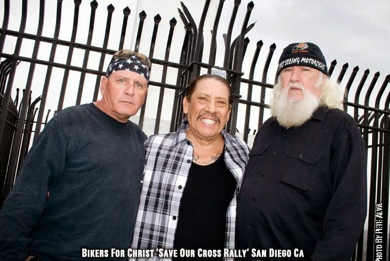
RUSTY DANNY
ANNIE KO PHILIP
PHILIP & ANNIE
OUT & ABOUT
OOHRAH...
OOHRAH
ONCE A MARINE,ALWAYS A MARINE
ONCE A MARINE,ALWAYS A MARINE
American Soldier Network GIVING BACK
GIVING BACK
CATHY & BILL
PHILIP & DANNY & BILL
MOUNT SOLEDAD
bills today
EMILIO & PHILIP
WATER & POWER
WATER & POWER
bootride2013
BIKINI BIKE WASH AT SWEETWATER
ILLUSION OPEN HOUSE
FRIENDS
GOOD FRIENDS
BILL,WILLIE G, PHILIP
GOOD FRIENDS
GOOD FRIENDS
Friends
- http://www.ehlinelaw.com/losangeles-motorcycleaccidentattorneys/
- Scotty westcoast-tbars.com
- Ashby C. Sorensen
- americansoldiernetwork.org
- blogtalkradio.com/hermis-live
- davidlabrava.com
- emiliorivera.com/
- http://kandymankustompaint.com
- http://pipelinept.com/
- http://womenmotorcyclist.com
- http://www.ehlinelaw.com
- https://ammo.com/
- SAN DIEGO CUSTOMS
- www.biggshd.com
- www.bighousecrew.net
- www.bikersinformationguide.com
- www.boltofca.org
- www.boltusa.org
- www.espinozasleather.com
- www.illusionmotorcycles.com
- www.kennedyscollateral.com
- www.kennedyscustomcycles.com
- www.listerinsurance.com
- www.sweetwaterharley.com
Hanging out
hanging out
Good Friends
brothers
GOOD FRIENDS
EMILIO & SCREWDRIVER
GOOD FRIENDS
Danny Trejo & Screwdriver
Good Friends
Navigation
Welcome to Bikers of America, Know Your Rights!
“THE BIKERS OF AMERICA, THE PHIL and BILL SHOW”,
A HARDCORE BIKER RIGHTS SHOW THAT HITS LIKE A BORED AND STROKED BIG TWIN!
ON LIVE TUESDAY'S & THURDAY'S AT 6 PM P.S.T.
9 PM E.S.T.
CATCH LIVE AND ARCHIVED SHOWS
FREE OF CHARGE AT...
BlogTalkRadio.com/BikersOfAmerica.
Two ways to listen on Tuesday & Thursday
1. Call in number - (347) 826-7753 ...
Listen live right from your phone!
2. Stream us live on your computer: http://www.blogtalkradio.com/bikersofamerica.
Good Times
Hanging Out
Key Words
- about (3)
- contact (1)
- TENNESSEE AND THUNDER ON THE MOUNTAIN (1)
- thinking (1)
- upcoming shows (2)
Blog Archive
-
▼
2011
(5448)
-
▼
September
(501)
- BREAKFAST AND LUNCH
- Here is a message from RC
- California - Hells Angels arrested on drug charges...
- SAN DIEGO CA - Hell's Angels gang members arrested...
- Nevada - SPARKS, Nev. - Officials know who killed ...
- Nevada - Arrest warrant issued for San Jose-area V...
- Sparks, NV - Long History Of Violent Rivalry Led T...
- AUSTRALIA - ABC journalist assaulted while coverin...
- Sheriffs call for immigration change in Mass. - Br...
- LAKE COUNTY, Calif. - Attorney for alleged Hells A...
- Pennsylvania - true colors: Cops vs. Pagan's
- Canada - Bureaucrats back biker bar
- AUSTRALIA - Police strike against Comancheros
- Activists launch petition campaign to repeal new p...
- AUSTRALIA - Police arrest 37 in bikie drug crackdown
- Lawsuit Challenges Nevada's Motorcycle Helmet Law
- Two wheels.... and... just watch and enjoy!~
- CALIFORNIA - Helmet Bill AB 695
- Man fatally shot near motorcycle club in Oakland,Ca
- Denmark - Biker gangs on welfare
- Feds arrest numerous Bandido motorcycle club members
- Russell Fitzgerald Apologizes For Bra Trick At Pub...
- LAS VEGAS - BikeFest organizers stress safety of e...
- Class Action Law Suit for Unlawful Enforcement of ...
- POCKET-SIZED U.S. CONSTITUTION
- 1st Saturday BBQ - Saturday, October 1, 2011
- Hells Angels Leader Mourned Following Casino Shootout
- CA - San Jose: Family and friends mourn local Hell...
- Biketoberfest 2011 planned in Daytona Beach, Florida
- PA - Jury selection delayed in Campbell murder tri...
- CANADA - Put shelter for homeless behind HA clubhouse
- CA-CHP reports decline in motorcycle-involved coll...
- Ca - Man shot dead at Oakland motorcycle club
- California - Hells Angels members charged with mor...
- FBI's undercover motorcycle shop nets dozens of ar...
- Texas - Two Johnson County men included in motorcy...
- Badass Boys: Are the Pagans roaring onto the comeb...
- SAN ANTONIO - Almost 40 biker gxxx members, associ...
- Pennsylvania Reconsidering Repealed Motorcycle Hel...
- The government to shut down Gibson Guitars.. sign ...
- UK - Bikers join in national protest with a go-sl...
- WHEN GRANDMA GOES TO COURT
- More Hells Angels Casino Murder Details Emerge
- CALIFORNIA - Girl battling kidney disease getting ...
- Federal Lawsuit Filed Against Helmet Law Enforcement
- Sparks police: Casino video shows shooting at John...
- Court documents: Hells Angels president seen punch...
- AUSTRALIA - Alleged cocaine kingpins' big day
- AUSTRALIA - Outlaw motorcycle clubs are a concer...
- AUSTRALIA - Jury considers fatal bike airport bra...
- CALIFORNIA - Motorcycle Safety Program in Oceanside
- UK - Bikers stage M1 protest over EU modification ...
- United Kingdom - Motorcyclists angry at proposed n...
- United Kingdom - Motorcycle Action Group stages EU...
- the "LOCAL 6 E-MAIL BLAST"
- ABATE of CA's latest newsletter the Bailing Wire i...
- The Constitution: The God That Failed (To Liberate...
- WEDDING RING IS IN FOR REPAIRS
- Can't believe this made national news....
- CA Redistricting Question
- Nevada Police stay alert after biker shooting
- Washoe Co., NV - Washoe's counterterrorism unit: N...
- Sparks, NV - Biker gang member points gun at El Do...
- JAN 9 2012 Sacramento Rally
- Gang violence kills head of HA Chapter
- 1 000 Bikers Join Protest in Bulgaria's Katunitsa
- GEORGIA - Bikers hit streets to support wounded Ma...
- Twilight Zone - San Diego
- AUSTRALIA - Bikies crackdown nets guns, drugs
- NEVEDA - Safety is essential in a state that depen...
- Lake of the Ozarks, Mo - Highway Patrol alters tes...
- The 4th Annual JJ Harris Ride
- Study This
- Five things you can never recover:
- San Jose Hells Angels leader killed during shootou...
- CANADA - New pot laws could overwhelm B.C. jails
- NYC Police Commissioner Tells Cops to Stop Arresti...
- Does Canada need to crack down on drug crimes?
- CANADA - What's in the Tory crime bill — and what...
- Preventing Police Abuse
- Hog Wild in China
- Reno, Nev. – Police: Brawl at Silver Legacy connec...
- Eyewitness: As bullets flew in Nugget shooting, by...
- AIKEN, S.C. - Suspect in fatal SC hit-and-run retu...
- Australia - Police keep close watch on Ballarat as...
- PA - Glasser was 'terrified' before death
- If We Acknowledged the Secret Law, It Wouldn't Be ...
- Nevada Street Vibrations Motorcycle Event Cancelle...
- CA Hells Angel boss dead in Nev. casino shootout
- NEVEDA - Hell's Angels motorcycle club member faci...
- Reno, NV - Eyewitness: A Hells Angel fired the fir...
- Hells Angel's slaying prompts state of emergency i...
- Disclaimer:
- OCEANSIDE CA - Police to increase motorcycle safet...
- Escondido, CA - City pays $20K to settle claim by...
- MASSACHUSETTS - Berkshire County Lobster Fest
- How's your tolerance?
- L.A. tries to stop Encino marijuana dispensary
- Australia - Biker stunt terrorises movie patrons
- UNITED KINGDOM - Bikers to take part in A63 go-slo...
- SAN BERNARDINO CA - Hearing set in "Devil's Profes...
- INTERESTING.....
- AUSTRALIA - Meet NSW's most wanted
- Reno, NV - Vendors react to Sparks Street Vibratio...
- Color of Law Abuses - FBI - www.injusticeeverywher...
- Searches Based on Consent
- RENO, NEVEDA - BREAKING: State of Emergency in Spa...
- Biker gangs eyed in fatal Sparks casino shooting
- Sparks, Nevada - Gunfire Erupts Inside John Ascuag...
- AUSTRALIA - Judge sums up in bikie airport murder ...
- CA - Oceanside Police To Focus On Motorcycle Safety
- St. Louis, MO - Massive motorcycle ride prompts se...
- Australia - Bikies' hunt for members sparks fears ...
- Tasmania - Man faces trial on Rebels drug charges
- Australia - Bikie charged over basement drug lab
- Los Angeles, CA - Chosen Few Black Biker Club's De...
- Australia - Elite school slammed for bikie escort
- Canada - Motorcycle riders 'not anti-social bullies'
- ILLINOIS: Kill a Biker, Go To Jail Doin' it For th...
- CA - AB 1047, as introduced, Vehicles: motorcycl...
- OMCG associate charged over alleged drug manufactu...
- ARIZONA - Heads should roll in administration’s Fa...
- Hells Angels, auto dealer team up for girl's fundr...
- CANADA - Outlaw biker ranks growing in Alberta
- Safety: Make ABS compulsory on big bikes, says IAM
- National Motorcycle Thefts Down 24 Percent Since 2007
- A Request for Volunteers
- GO DALLAS - Uninsured Cars Off The Road
-
▼
September
(501)
Bikers of America, Know Your Rights!... Brought to you by Phil and Bill
Philip, a.k.a Screwdriver, is a proud member of Bikers of Lesser Tolerance, and the Left Coast Rep
of B.A.D (Bikers Against Discrimination) along with Bill is a biker rights activist and also a B.A.D Rep, as well, owner of Kennedy's Custom Cycles